

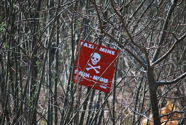
Somewhere in the world right now, a farmer is walking a field that might kill them. A child is taking a shortcut to school across ground that hasn't been cleared. In at least 57 countries, live antipersonnel landmines remain buried in the earth — silent, patient, and lethal.
In 2024 alone, 1,945 people were killed by landmines and 4,325 were injured, according to figures cited by researchers at the Rochester Institute of Technology. Ninety per cent of casualties were civilians. Nearly half were children.
The technology to change this is finally catching up with the scale of the problem.
From handheld detectors to airborne sensors
Traditional demining relies on people on the ground — handheld metal detectors, ground-penetrating radar, manual probing, even trained animals. Each method has serious limitations. Metal detectors struggle in mineral-rich soil and can miss plastic mines. Radar generates high false-alarm rates in wet or uneven terrain. Manual probing is agonisingly slow and exposes deminers to enormous risk.
Researchers led by Sagar Lekhak, a PhD student in imaging science at Rochester Institute of Technology, are working on a radically different approach: drone-based detection systems powered by artificial intelligence.
The concept brings together multiple aerial sensors — thermal cameras that detect temperature differences between mines and surrounding soil, multispectral and hyperspectral sensors that identify material signatures, LiDAR that maps subtle surface disturbances, and magnetometers that detect buried metallic components. Used together, these sensors can address the variety of mine types and conditions found in real-world environments.
Early results are promising. Research by Lekhak and his colleagues found that drone-mounted magnetic sensing could detect metallic targets with accuracy comparable to ground-based methods — while reducing human risk and increasing survey speed roughly tenfold.
Building the benchmark
But there's a catch. Training AI to reliably spot landmines requires data — and until now, there hasn't been a comprehensive public dataset for researchers to work with. Without standardised benchmarks, algorithms can't be properly compared, and systems developed in labs may fail in the field.
To fill this gap, the Rochester team collaborated with the nonprofit Demining Research Community to collect a massive, georeferenced dataset at a controlled test field in Oklahoma, featuring over 140 inert landmine and unexploded ordnance targets surveyed by nine different sensor types from both ground and air.
They've expanded the effort internationally through a partnership with the Royal Military Academy of Belgium, deploying over 110 replicas of PFM-1 mines — the small, plastic "butterfly mines" notorious for their resemblance to toys — across varied terrain and vegetation. Each mine was precisely geolocated using GPS.
These datasets, currently being processed, will be released as open-access resources — the first of their kind.
Teaching AI to say "I'm not sure"
Perhaps the most significant innovation is one of honesty. In landmine detection, a false negative — a mine the system misses — can be fatal. Lekhak's research focuses on building AI systems that can quantify their own uncertainty, effectively telling operators: "I'm not confident about this area."
Rather than forcing AI to produce a definitive yes-or-no answer, the system assigns an uncertainty score. The noisier or more ambiguous the sensor data, the higher the score — flagging areas that need human verification.
"At its core, this research is not about algorithms or drones," Lekhak writes. "It is about people. It is about farmers reclaiming their land, children walking safely to school, and communities rebuilding without fear."
A long road, but a faster one
Demining operations cleared 105,640 mines in 2024, but with new conflicts — particularly in Ukraine — the number of mines continues to grow. No single technology will solve the problem overnight.
What drone-based AI detection offers is a way to dramatically accelerate the process while keeping humans out of harm's way. If open-access datasets enable researchers worldwide to develop and improve detection algorithms, the cumulative effect could be transformative.
The goal, as the researchers put it, is to help turn post-conflict landscapes "back into places where life can grow again." For the millions of people living alongside buried mines, that can't come soon enough.